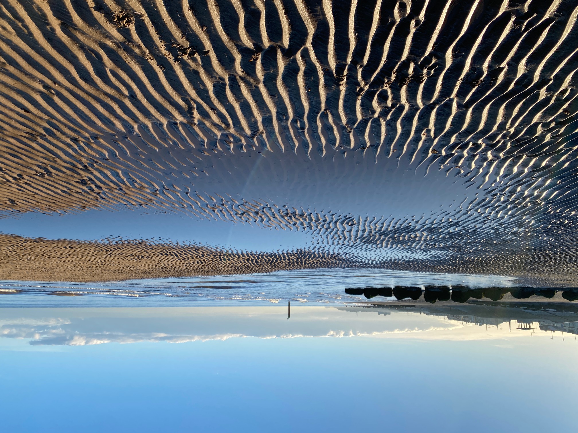
The beach at Cleveleys with Blackpool Tower just visible in the distance
STAGE 72 (W13) – FLEETWOOD to CLEVELEYS
5.25 miles – 2 hours walk
59 feet climbed – highest point 61 feet – The Mount
A brief look at Fleetwood and some of its history and then it’s a long walk along the coast to Cleveleys but with lots of interest.
A map of Stage 72 can be found below courtesy of Ordnance Survey maps. You can subscribe yourself using this link, https://osmaps.ordnancesurvey.co.uk, which will enable you to import the GPX file which can be downloaded below.
Download file for GPS
To download the GPX file for this stage click on the link above.
Exit the ferry station.
Before we venture any further we need to consider the life of one Peter Hesketh. Peter was born in 1801, in Wennington Hall not far from Melling on the Northern Loop. He was descended from the Fleetwood family who had owned significant amounts of land in West Lancashire for over 200 years from Heysham in the north to Southport and North Meols in the south. Peter inherited this estate in 1824 when his elder brother died. He changed his name by Royal assent to Hesketh Fleetwood. He was educated at Trinity College Oxford and spent much of his early life in the south from London to the south coast, including the new seaside town, St Leonards-on-Sea. His interest in architecture resulted in his friendship with James Burton, the developer of this seaside resort, and his son Decimus, who was also an architect. Peter and Decimus were involved in the formation of The Athenaeum Club and Decimus designed the club’s building in Pall Mall.
In 1830 Peter was appointed High Sheriff of Lancashire and became a Tory MP for Preston in 1832. He opposed monopolies, slavery and capital punishment and was in favour of the Corn Laws. In 1838 he was knighted in Queen Victoria’s Coronation Honours list and became the Baronet of Fleetwood.
In 1830, as the High Sheriff, he attended the opening of the Liverpool and Manchester Railway. This was possibly the catalyst for his idea of building a seaside resort accessible by train to the mill workers of Lancashire. He decided upon Rossall Point at the mouth of the River Wyre, which was then uninhabited but had great views of Morecambe Bay and the Lake District. He was also persuaded to expand the project to include the building of a port to provide competition to Liverpool and another outlet for the Manchester and Lancashire Mill owners. He decided to call the new town Fleetwood. He employed his friend Decimus to draw up plans, which were ready in 1835. Work started the following year, and Peter also took on the financial burden of building the railway. Of course, the construction costs spiralled out of control and Peter incurred significant debts and started to withdraw from society. In 1840 the railway, the Preston and Wyre, was completed. In the face of enormous debts, Peter was compelled to sell some of his estates including Blackpool and Southport and in 1844 he left Lancashire.
Whilst the new town had originally flourished it soon faced competition from Lytham and Preston as a port. It also suffered when its importance on the route to Scotland was lost as more powerful trains were able to cross the hills north of Preston to Glasgow. Development slowed without the powerful vision and drive of Peter. We will see some of the results of this incredible man on the route to Cleveleys.
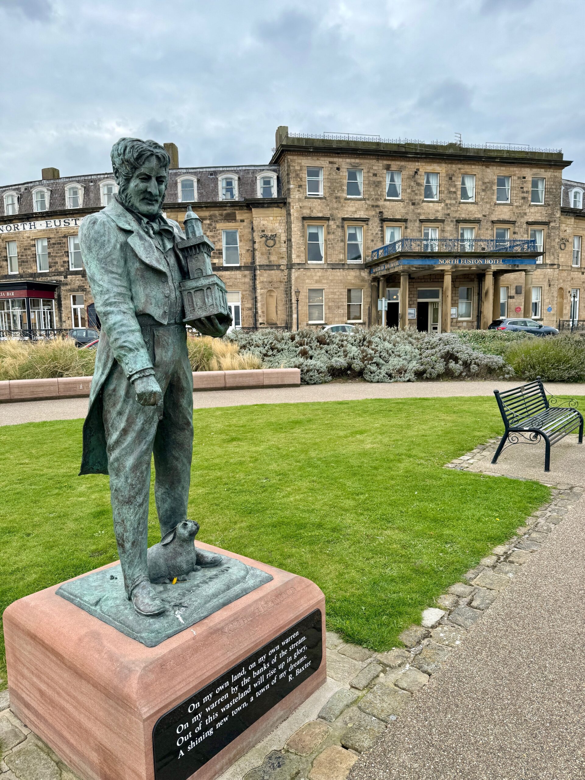
The statue of Sir Peter Hesketh Fleetwood and the North Euston Hotel behind
Turn left and then cross the road – beware trams and cars! Enter Pharos Street and head to the impressive lighthouse tower. Yes, this is a lighthouse and perhaps unique in that it stands within a residential street. It is officially called the Upper Lighthouse or more commonly Pharos Lighthouse after the ancient lighthouse in Alexandria. It was completed in 1840 and is made of red sandstone from Runcorn in Cheshire. It stands 93 feet high. More of this later!
Turn right at the lighthouse and head north along Upper Lune Steet. At the end cross over the road passing the tram and bus terminus on your right so that you are opposite the North Euston Hotel. You may even have stayed here overnight.
Funded by Sir Peter Hesketh-Fleetwood as part of the development of the new town and designed by Decimus Burton, it was opened in 1841 and derives its name from the fact that it stood at the end of the railway line from London Euston. At that point there was no rail route north to Glasgow along the west coast, so the journey involved a steamer from Fleetwood to Ardrossan and then rail again to Glasgow. The hotel was therefore a popular stop off for the wealthy. In 1847, Queen Victoria stopped at the hotel on her journey north to Scotland. Unfortunately, after 18 years it closed due to lack of visitors as direct rail links to Scotland were developed. It was sold to the Government who converted it into Euston Barracks and Fleetwood became a garrison town. Fortunately, it was converted back into a hotel in the 1890’s and although it has had many owners since, it remains true to its original purpose with over 50 rooms.
Enter the gardens on your right and pay your respects to Sir Peter, the man who, as we now know, was responsible for developing Fleetwood – there is a statue here commemorating him. I hope you agree that his story is a fascinating one and worth the many words above.
Exit the gardens onto the Esplanade back to almost where you started but just north of the RNLI station and the Ferry. Cross the road and turn left and head along the front. Look out for the moving statue called “Welcome Home”. It depicts a woman and child welcoming home their husband and father. It was erected as a tribute to the families of Fleetwood fishermen who have followed this often perilous and dangerous occupation.
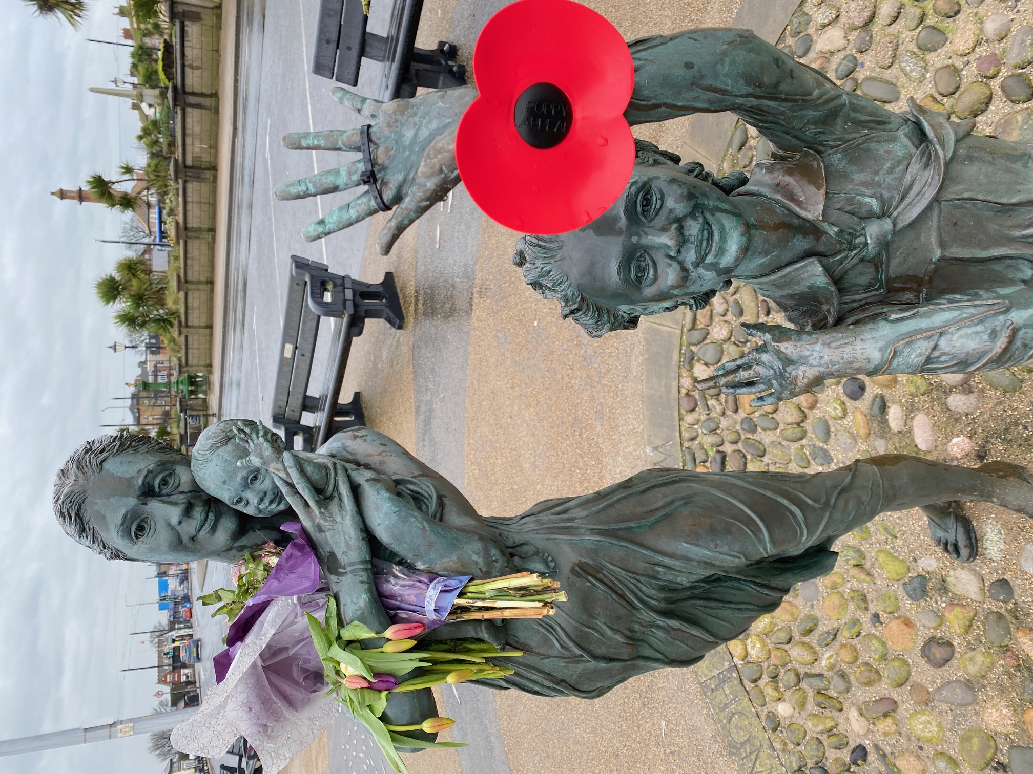
“Welcome Home”
Continue on to a second lighthouse called the Lower Lighthouse. It is just 34ft high but pretty and ornate. Both lighthouses actually work together. In order to gain safe access to the port through the treacherous sandbanks in the Wyre Estuary, the ships had to line up the light of the larger Pharos tower immediately above the light of the Lower tower. There was actually a third lighthouse out in the channel, but little remains of it.
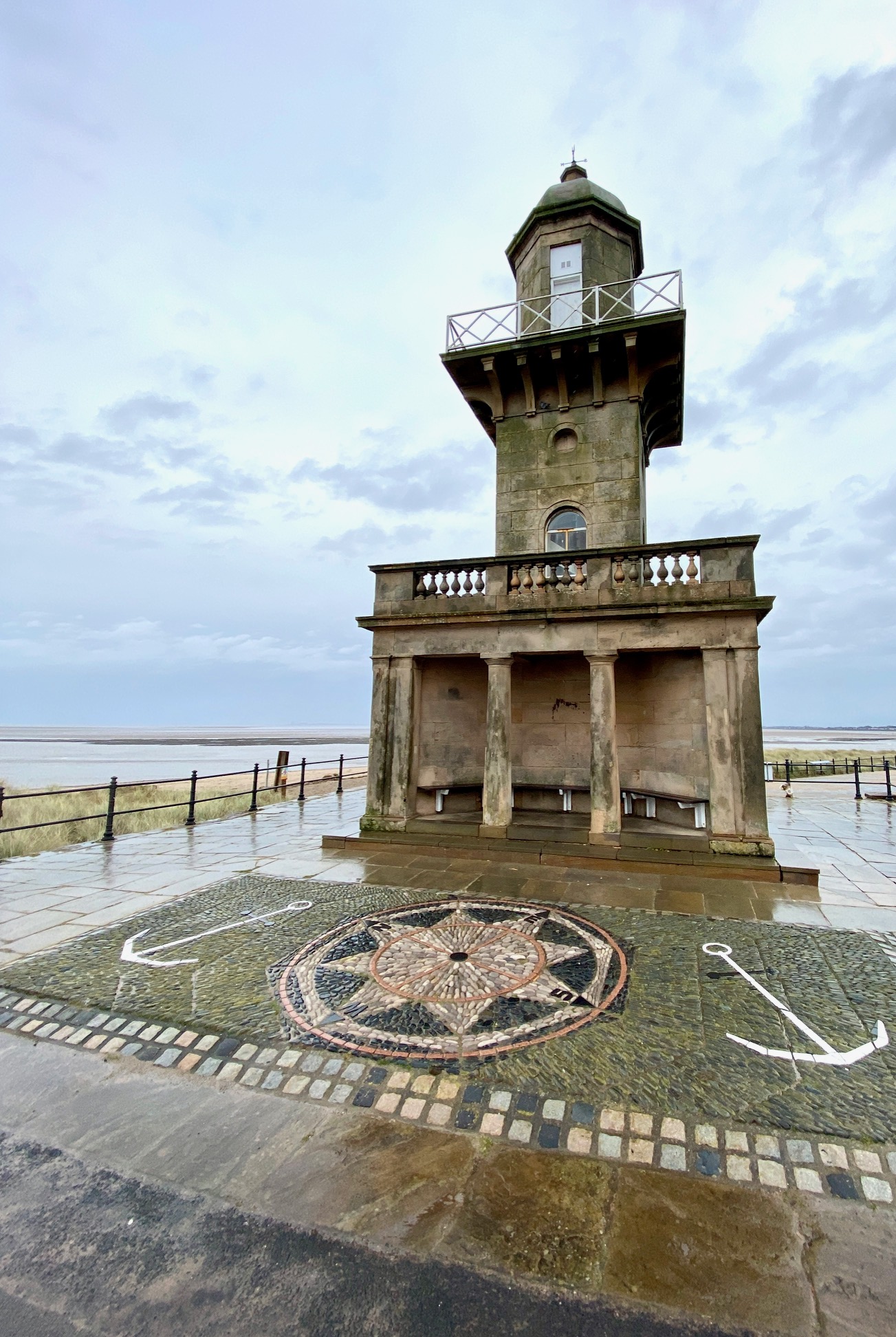
The Lower Lighthouse
At this point we say goodbye to the River Wyre, which we have been following for about 20 miles now. A modest river but quiet and will we ever forget the wet salt marshes that dominate much of its final course?
Follow the promenade along the seafront. When you come to the Fleetwood Health and Fitness Centre on your right, cross over the road and enter the walled grassy area on your left. This is the Mount, the highest point in Fleetwood, which is a large natural sand dune. Follow the path to the top where you will find the Pavilion, a Grade II listed building. This was built between 1902 and 1904 and designed, like many buildings in Fleetwood, by Decimus Burton. It gives great views across Morecambe Bay towards the peaks of the Lake District, one remarked upon in Bill Bryson’s book “Notes from a Small Island”. Also, just on the other side of the Esplanade, you can see the dome of the Marine Hall, an art deco building from the 1930s, now an entertainment venue. The dome above the main ballroom houses impressive glass work.
Descend the other side of the hill to the Mount Hotel and rejoin the Esplanade. Rather than continuing along the main road take the road on the other side towards the seafront. Turn left and then follow the promenade along the seafront. Pass the Boating Lake and head to the Lookout Station at Rossall Point. The Rossall Point Tower is 42 feet high and is designed to look as if it is leaning into the wind. The National Coastwatch Institution occupies the second floor but there is generally public access to the building including a viewing deck on the roof. Do make sure you take advantage of this as it gives super views along the coast and beyond including the Bowland Fells. There are also public toilets next door.
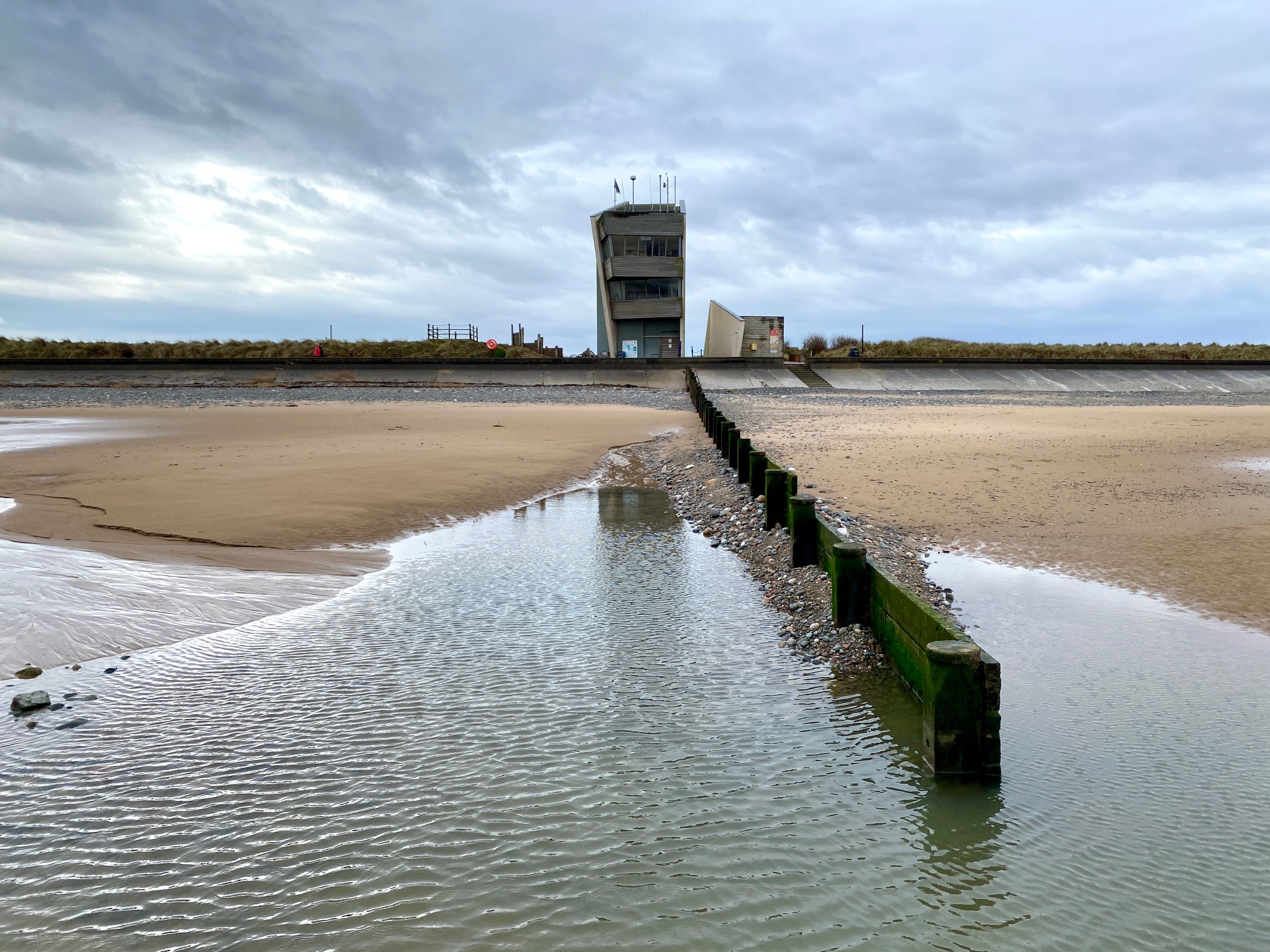
The Lookout Tower
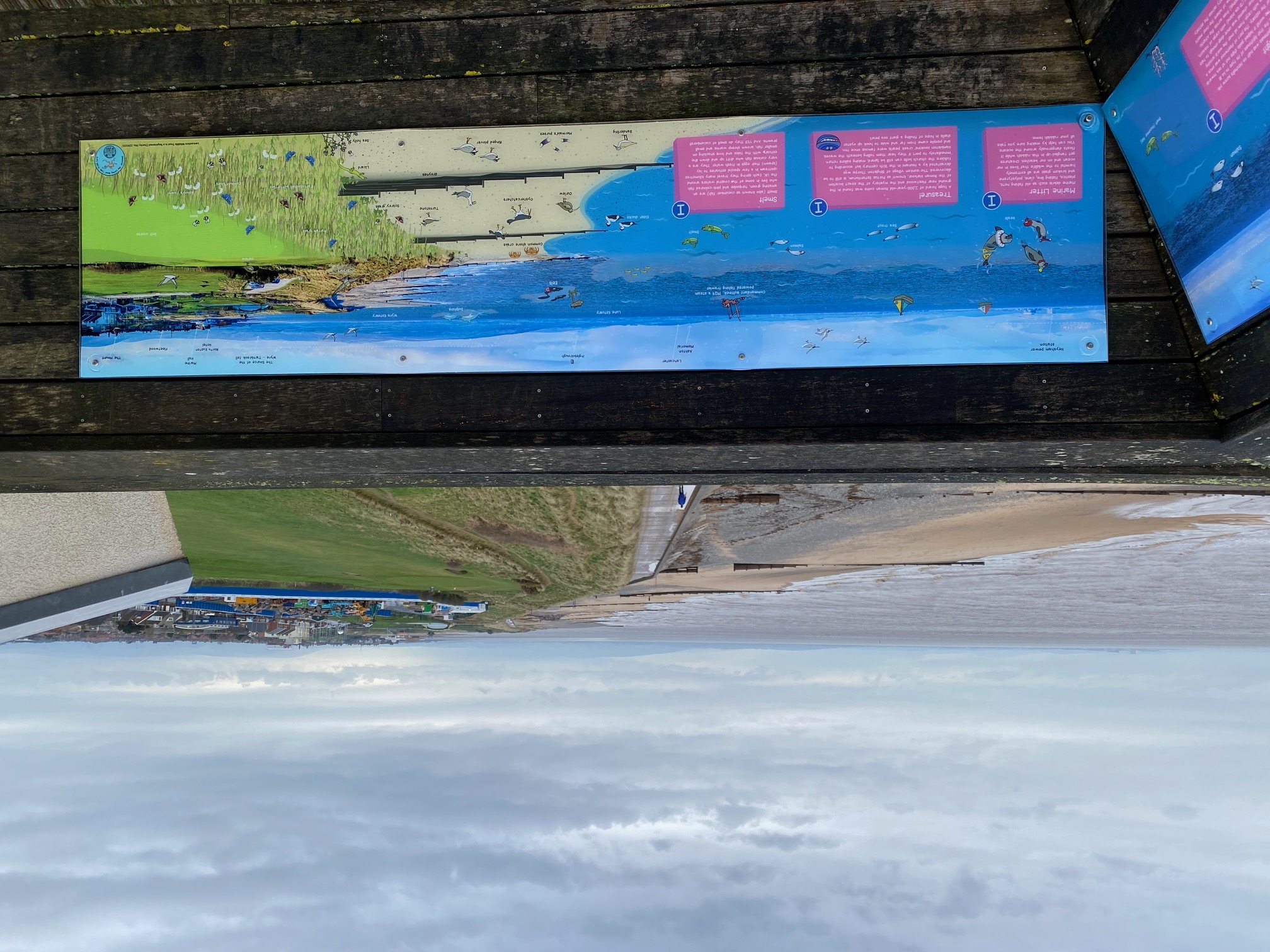
The view from the top of the Tower
From Rossall Point continue along the concrete promenade as it bends around from a westerly direction to a southerly one. We are now on the homeward stretch – just 10km or so to the end in Blackpool. However, as well as the sea there is lots of interest along the route as we will see.
This section of promenade marks the beginning of the Wyre Mythic Coastline Trail, although most is further south in Cleveleys itself. This is an artwork trail along the front, which brings to life the Sea Swallow book – a children’s book written by Gareth Thompson and illustrated by Hannah Magee. The story is a magical tale based upon the village of Singleton Thorpe, which was drowned off the coast at Cleveleys in the sixteenth century. The heroine is a girl called Mary who tries to save her village from a Sea Ogre and all that she encounters along the way including a merboy, a golden shell and the Lune Deep. This starts here with a concrete mural with words from the story. More later.
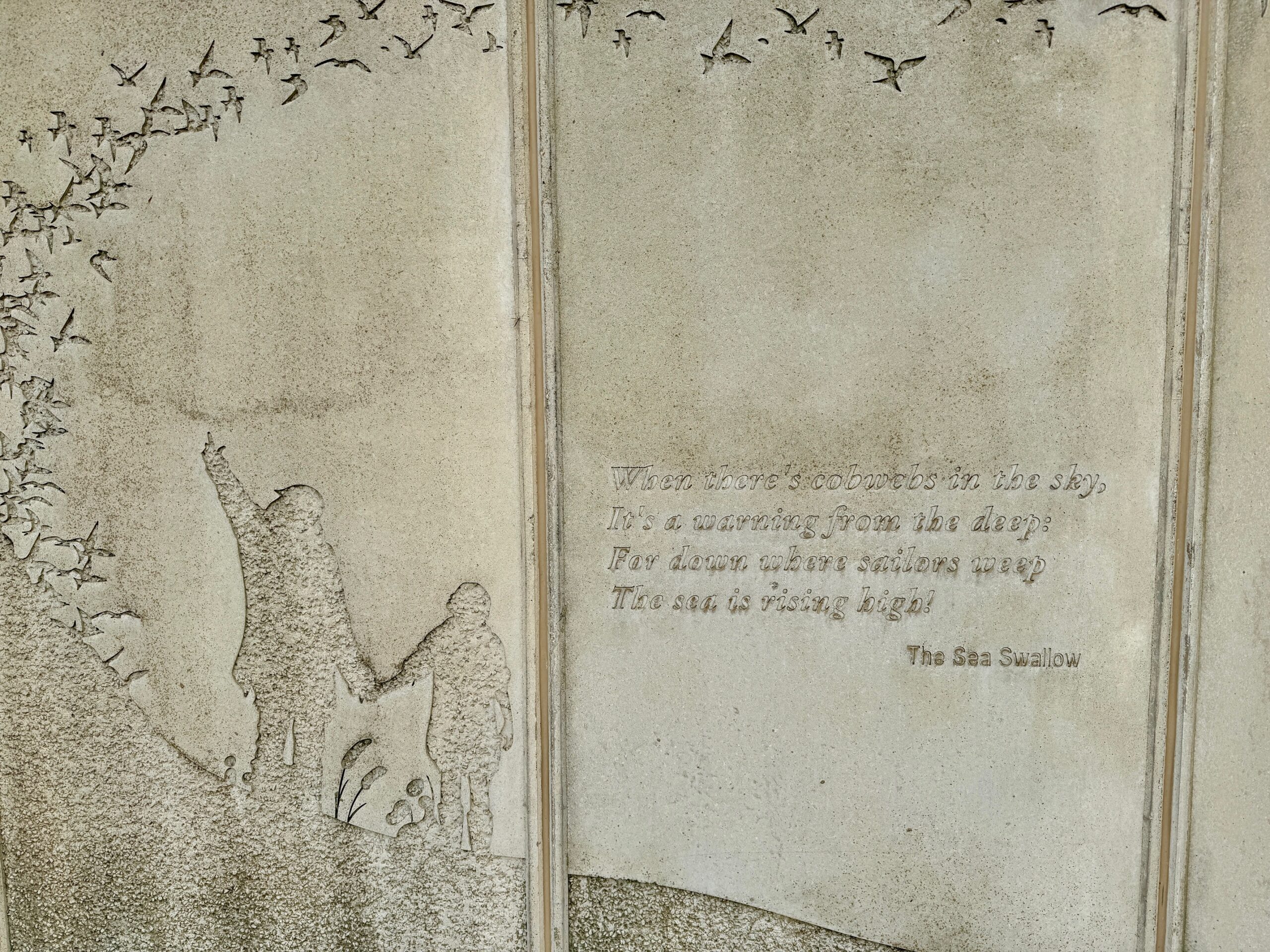
The Sea Swallow mural in concrete and the beginning of the Wyre Mythic Trail
After about one and a half miles, the road that runs parallel to the promenade bends inland and is replaced by a green space, which houses Rossall School. This was founded in 1844 as a sister school to Marlborough College. The main building is actually the ancestral hall of Sir Peter Hesketh-Fleetwood, who leased the building to the school to help his finances which as we know had been stretched by his over-investment in developing Fleetwood. He never returned and the school remains there to this day.
After Rossall school, the promenade is flanked again by a road on our left and the seashore on our right. After another 700 metres we come to an impressive café (Café Cove) which marks the start of a recently developed promenade and which also features five art structures that have been designed to bring the Sea Swallow story to life.
The first is the Seashell or Mary’s Shell which sits on the beach but can be accessed when the tide is out. It is a piece of coiled stainless steel in the shape of a shell, is four metres high, eight metres long and weighs 16.5 tonnes.
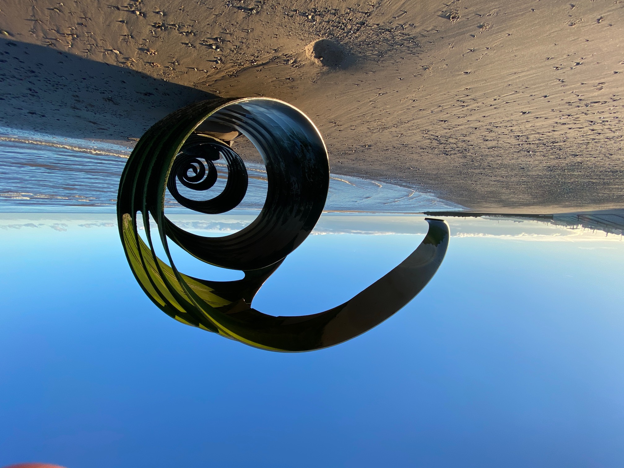
Mary’s Shell
Next, also on the beach, is the Sea Ogre itself but it is often missed as again it can only really be seen when the tide is out. It is close to one of the stone groynes so can be mistaken for part of this structure. It is carved out of limestone and weighs 12 tonnes.
The promenade itself is made out of lovely golden yellow precast concrete block mixed locally. The development is part of the Wyre Flood and Coastal Defence Strategy Plan which was developed to replace the ageing sea defences and secondly to give a more modern pleasing look, which it certainly does. It is punctuated by interesting leaning lights and covered seating areas.
The Stage ends at the end of the North Promenade, which is marked by the third piece of art, the Sea Swallows. This 10m high beacon, made from aluminium, features Sea Swallows at the top. Next to this is a public “piazza” and from here you can easily come off the promenade and access Cleveleys itself including its shops, cafes, bus station and trams by following Victoria Road West, which is one of the main streets in the town.
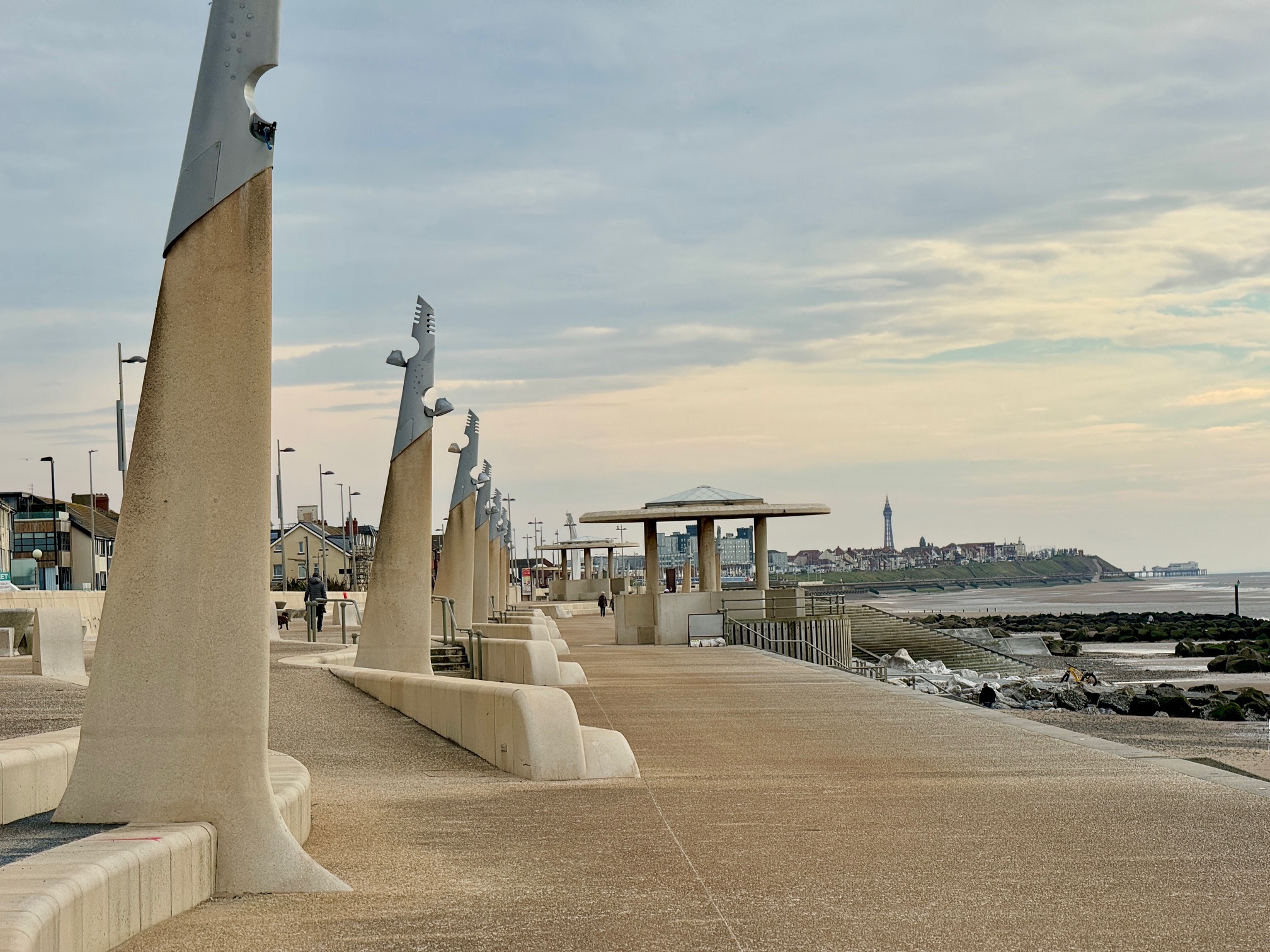
The impressive promenade at Cleveleys with distinctive lighting structures
END OF STAGE
Click here to go straight to Stage 73 (W14)
Provisions and accommodation can be found in Fleetwood and Cleveleys


