The unusual stile on Goodshaw Hill
STAGE 57 – RISING BRIDGE, ACCRINGTON TO LOVECLOUGH
3.0 miles – 1.5 hours walk.
511 feet climbed – highest point 1,216 feet -Goodshaw Hill.
Another modest and short stage climbing over Goodshaw Hill with only eight miles left when you finish. Decent views.
The map of Stage 57 can be found below courtesy of Ordnance Survey maps. You can subscribe yourself using this link, https://osmaps.ordnancesurvey.co.uk, which will enable you to import the GPX file which can be downloaded below. There is a small annual charge of around £30.
Download file for GPS
To download the GPX file for this stage click on the link above.
Cross the main road and find the pedestrian gap in the wall and the steps down to the road on the other side. Follow the road past houses and then under the dual carriageway. The Rossendale Way then turns left into fields immediately after the bridge but the paths are not good so please ignore the route of the Rossendale Way, until we meet up with it again in the next 10 minutes or so.
Continue along the road, past houses on your right and then around a left hand bend and continue along the road through the small village of Stone Fold, where the Rossendale Way joins back up with us. When you then come to a lone property the road splits. Bear right on to a tarmac lane and carry straight on up the slope. The lane then bears right at the top and then comes to a “crossroads”, with metal gates on the left and right. Turn left over a cattle grid and follow the track for about 150m. At end of the property on your left, which is currently being built, turn right up grassy track. Go straight on through two stile gates and then a metal stile gate. Bear left up the hill and follow a track. At the top is a large metal gate and metal stile gate. Go through and turn left up a grassy track heading north. Follow the fence on your left on top of the hill (Goodshaw) to large metal gate with an in-built stile gate.
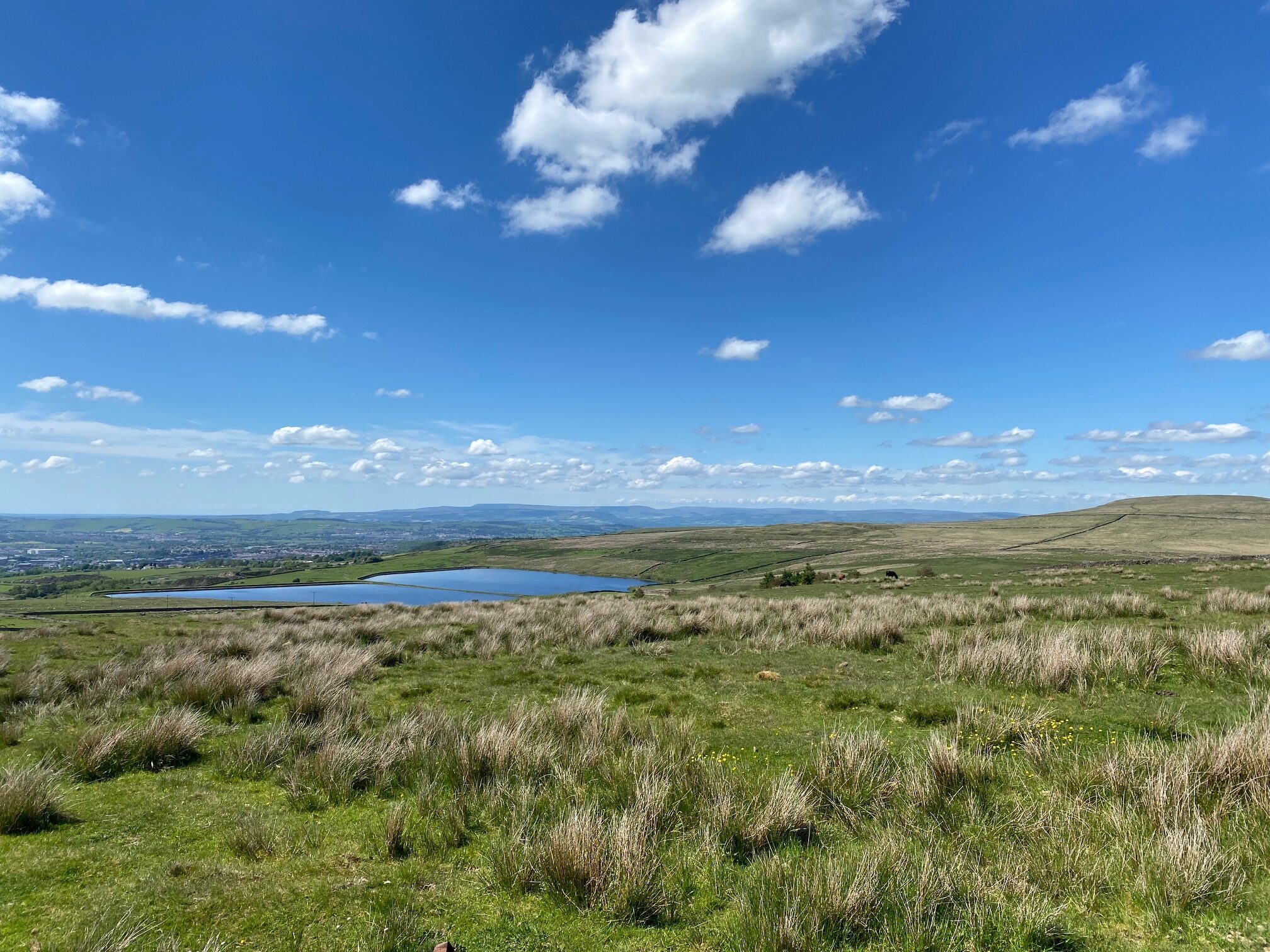
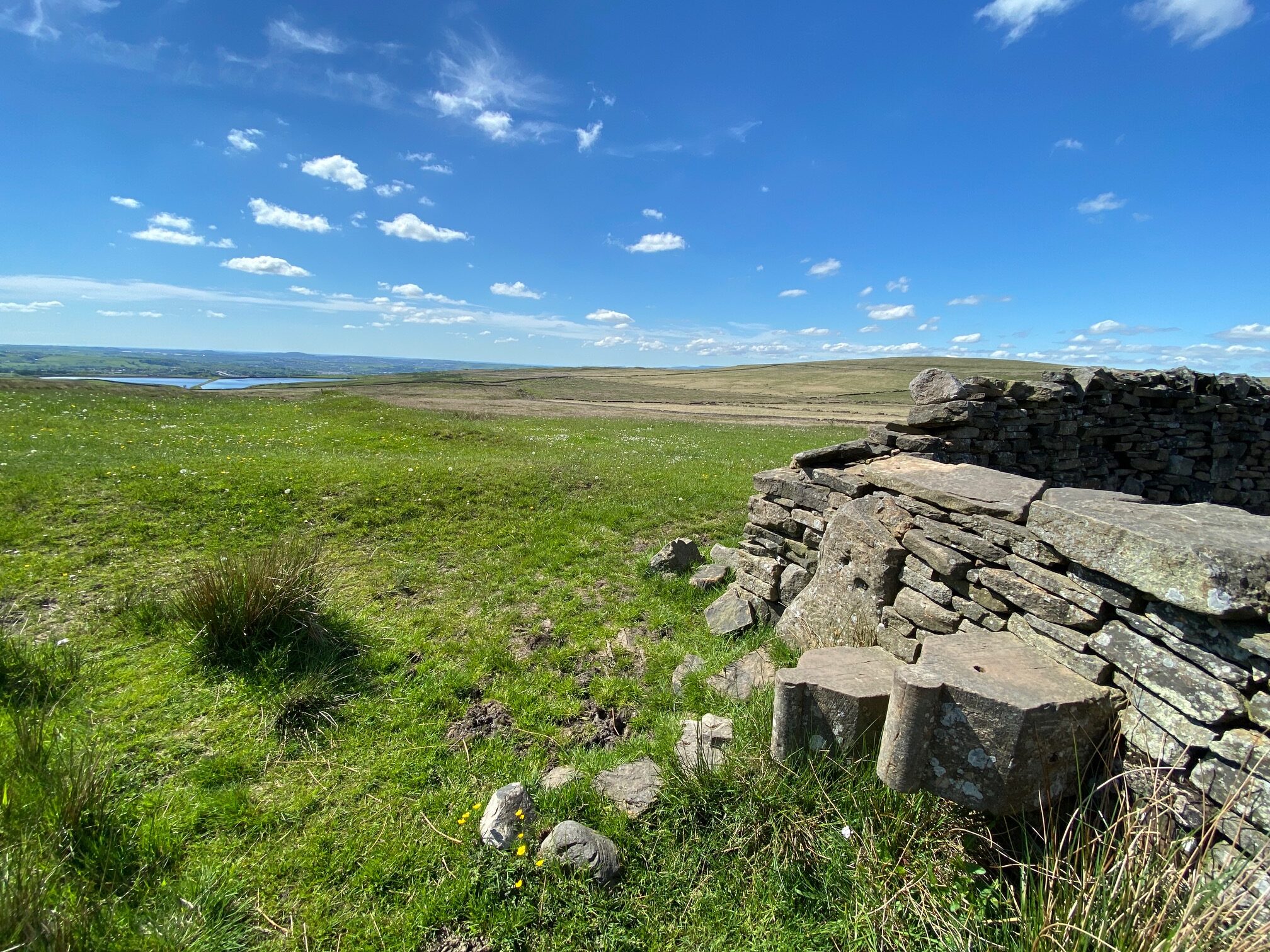
Views west from Goodshaw Hill
Carry straight on but now on the other side of the boundary wall. There are good views from here especially west, and also the hill called Hameldon. Carry straight on passing a fenced off square, pass the first ladder stile on your right and then on to a unique stone stile (made for carved stones reclaimed from a building) at a junction of walls before another ladder stile about 75m further on. Use the stone stile to cross onto the other side of wall.
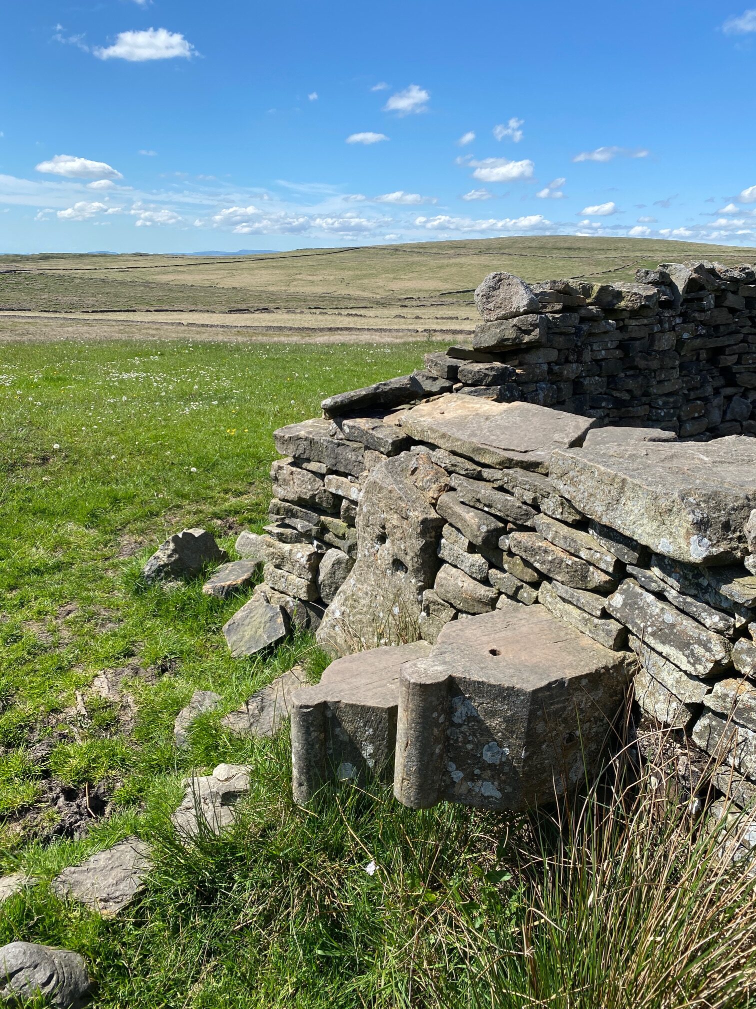
That stile again!
Head away from the wall, bearing slightly left, not along it, using the faint path which heads in the direction of a small wind turbine. At the corner of a fenced field, in which the turbine is situated, bear left down the hill behind a large property down to a wall. Turn right at the wall to the corner of another fenced field and then follow the path along the boundary fence on your right past a telegraph pole to a stile gate. Cross through into a large field. Follow the boundary on your left past gates to a property on the other side of the wall to a stile. Cross onto road and follow it down the hill to houses. Turn left then right. At the T junction turn left and follow the road up to main road in Loveclough – A682.
END OF STAGE 57
Click here to go directly to Stage 58
Loveclough is on a bus route, with the X43 service running every 15 minutes, which will take you into Burnley just a few miles away with accommodation options.
CIRCULAR/DAY WALKS


