
We say goodbye to Towneley Hall
STAGE 59 – TOWNELEY HALL, BURNLEY TO MANCHESTER ROAD RAILWAY STATION, BURNLEY
2.25 miles – 1.0 hours walk.
314 feet climbed – highest point 634
Having explored Towneley Hall we head to the finish – a short two miles. Initially we have a pretty wooded stretch but then it is mainly through terraced streets. At the very end we join the Leeds Liverpool canal for the last time and take a quick look at the Burnley Mile – a man-made embankment created through the centre of the town on which the canal runs.
Map of Stage 59 – Unfortunately OS maps of the Eastern Loop are not provided. However, if you e mail [email protected] and a full GPX file of the Eastern Loop will be sent to you and this can be down loaded on to OS maps at www.osmaps.ordnancesurvey.co.uk. As an alternative you can view the interactive Map of the Stage below oand/or download the GPX file for this Stage only by following the instructions below.
Lancashire Way Eastern Loop Stage 59 E17
Profile
From the front of Towneley Hall, head around the right hand side of the house to the back of the hall. Pick up the path that heads away from the house and take the second turning, which takes you to Foldys Cross. Bear right into the car park and then exit on to the main road.
Cross the main road on to a lay bye. Turn right and find the lane at end of the lay bye. Turn left up the lane and then through a stile gate. Turn right. The path then splits – bear right. Follow the railway in the cutting on your right and then on to and into a housing development – the Kilns. At end of this road you will see just to the right on the other side of the road – Mayfield Fold. At the right hand side of this is a footpath. Follow this along the side of the railway and then out on to a road. Turn right and cross the railway crossing. Take the first left onto Hollingreave Road – the Royal Butterfly pub is on the corner. Follow to the main road and a canal bridge. Cross over and the join towpath on your right.
Looking north along the Leeds Liverpool canal you will see the Burnley Embankment or the Burnley Straight Mile. it was constructed between 1796 and 1801 and carries the canal 60ft above and through the town. The embankment was a innovative solution to crossing the valley without the need for expensive locks both down into the valley and out again. It also meant that barges would not be held up. It is widely regarded as one of the “seven wonders” of the British Waterways.
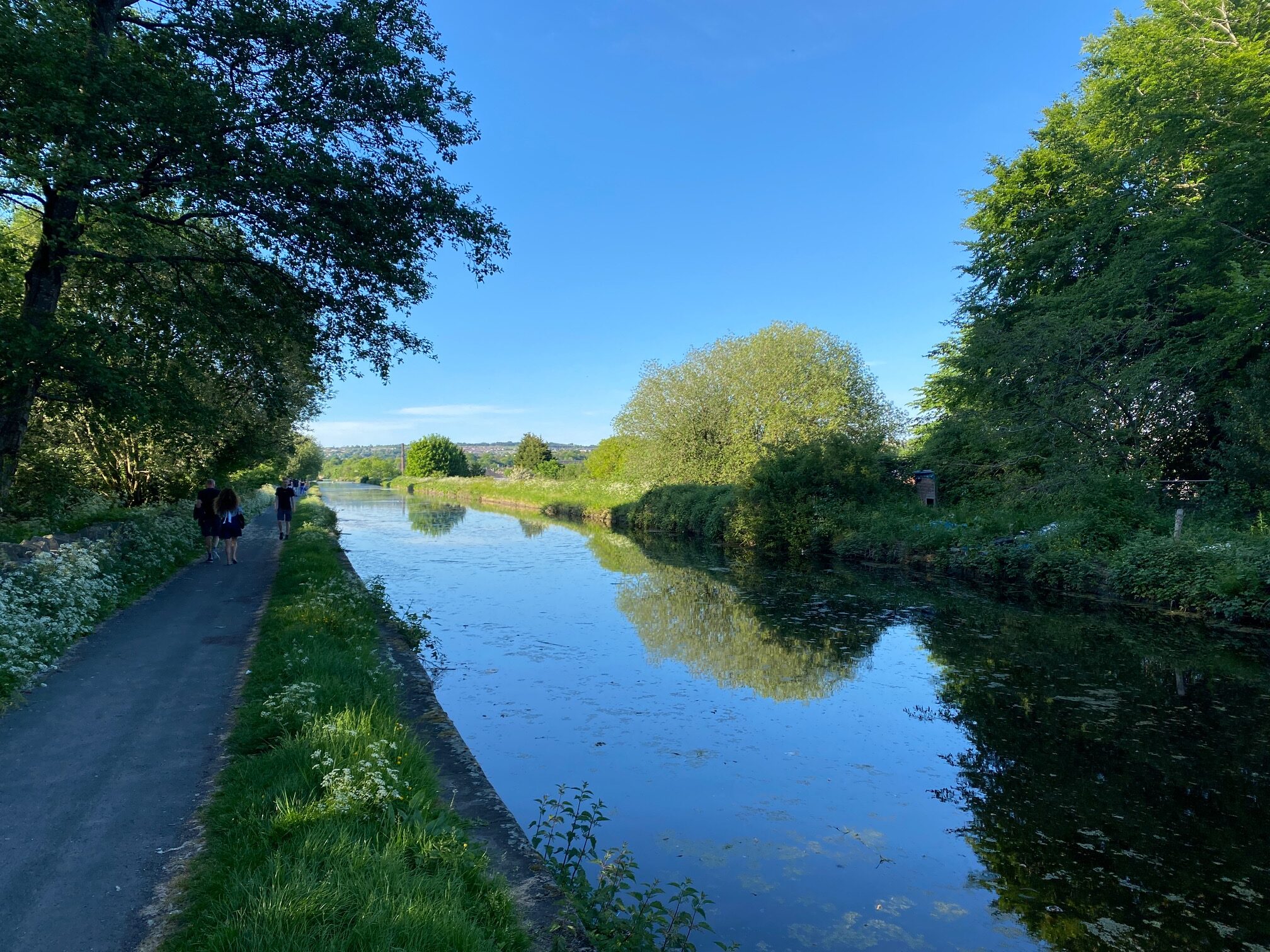
The beginning of the Burnley Mile
Turn back upon yourself and under the bridge that we have just crossed above i.e. away from the Burnley Mile in a SW direction. Follow the canal for about 300m back to Bridge 130B, which you may remember from the first Stage of the Eastern Loop and is marked by the distinctive wooden Burnley Way Marker post. Come off the canal up to the road and turn left up to a roundabout and then on to the railway station.
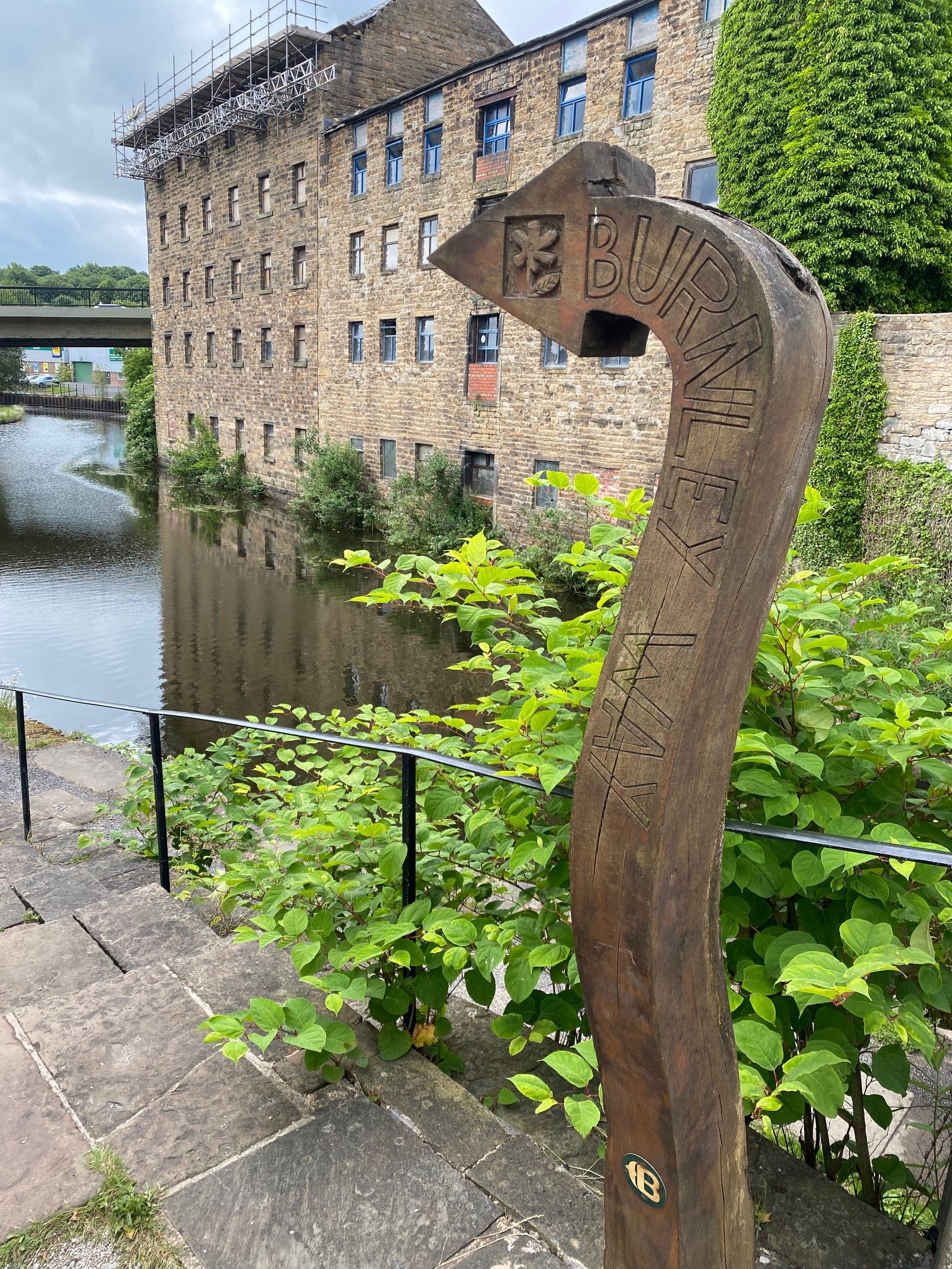
The end of the Leeds Liverpool canal in the Weavers Triangle.
END OF STAGE 59
END OF THE EASTERN LOOP
END OF THE LANCASHIRE WAY – ALL 396 MILES!!


